
ARTICLE #3 · HISTORICAL EVENTS
Hurricane Hugo: 37 Years Since a Category 4 Hurricane Struck the South Carolina Lowcountry
On the night of September 21, 1989, residents across the South Carolina Lowcountry watched one of the most powerful hurricanes in the state's history approach the coastline. Around midnight, Hurricane Hugo made landfall near Sullivan's Island as a Category 4 hurricane, bringing estimated sustained winds of 135–140 mph and a minimum central pressure near 934 millibars.
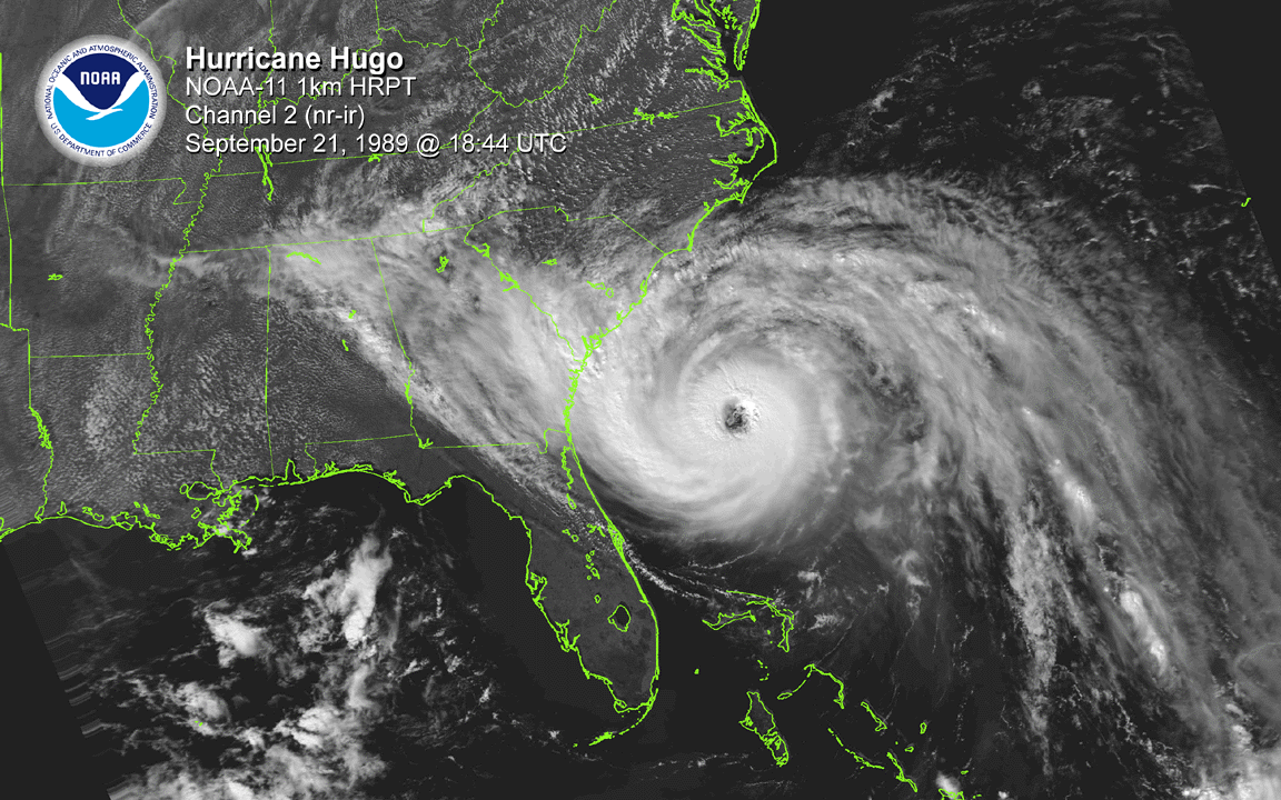
Hugo's story began nearly two weeks earlier when a tropical wave emerged from the coast of Africa. The system developed into a tropical depression on September 10 and strengthened into a hurricane three days later. Hugo eventually reached Category 5 intensity over the Atlantic before striking portions of the northeastern Caribbean, including Guadeloupe, St. Croix and Puerto Rico. After moving north of Puerto Rico, changes in the steering pattern began directing the hurricane toward the southeastern United States.
By September 21, Hugo was accelerating toward the Carolinas and strengthening again. The hurricane crossed the Gulf Stream and regained Category 4 intensity, developing a large eye as it approached South Carolina. Late that evening, the eye moved ashore near Sullivan's Island, placing communities around Charleston and especially areas immediately north of the city within Hugo's devastating inner core.
Devastation on Sullivan's Island
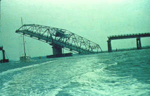
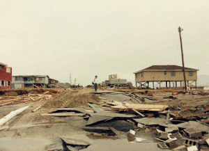
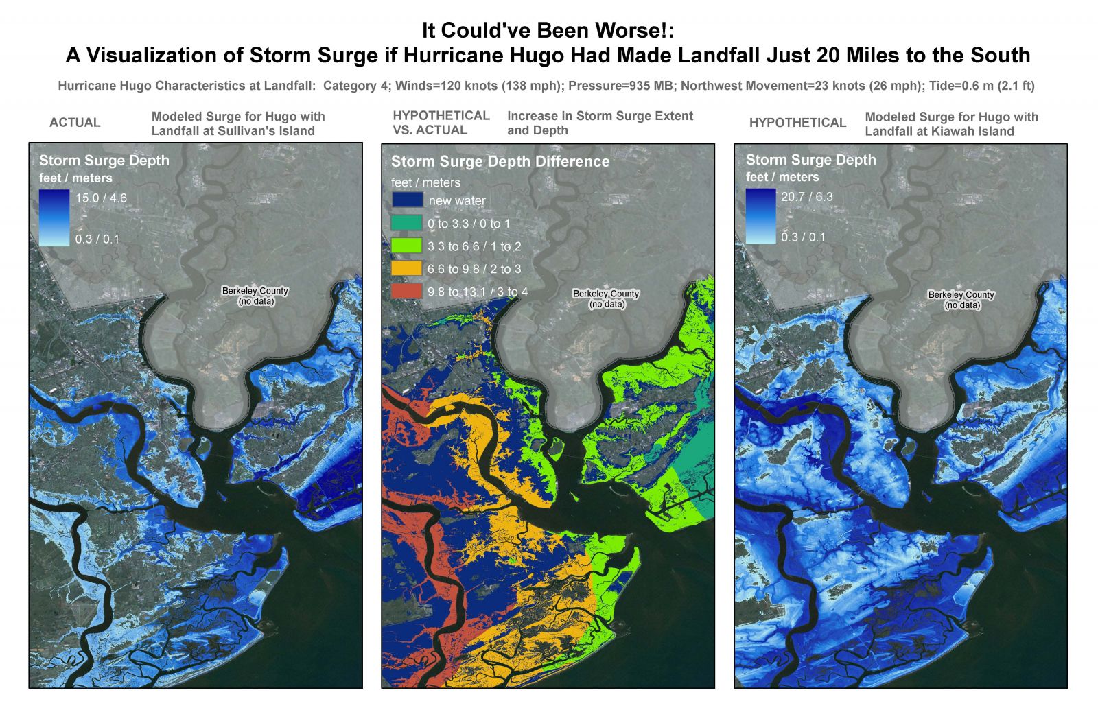
Few places experienced Hugo's power more directly than Sullivan's Island and Isle of Palms. Water reached approximately 13 feet above mean sea level on Sullivan's Island and 15 feet on Isle of Palms. Many older homes on Sullivan's Island were destroyed, while the majority of homes across the two islands were rendered uninhabitable. The Ben Sawyer Bridge connecting Sullivan's Island with the mainland was severely damaged, becoming one of the enduring images of the disaster.
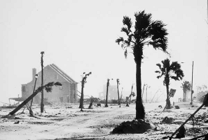
Even greater storm tides occurred farther north. At Bulls Bay, water reached approximately 19.8 feet above mean sea level, among the highest storm tides ever documented along the U.S. East Coast. McClellanville was devastated as the surge swept into the community, carrying boats inland and flooding an evacuation shelter at Lincoln High School.
Charleston itself sustained extensive damage. Downtown Charleston recorded a wind gust of 108 mph, Folly Beach reached 107 mph and Charleston International Airport recorded 98 mph. Most buildings in downtown Charleston suffered some damage, although Hugo's landfall north of the city prevented Charleston from experiencing the hurricane's worst storm surge. The National Weather Service notes that a slightly farther-south track could have produced substantially worse flooding downtown.
Hugo's Destruction Continued Far Inland
Hugo did not stop being dangerous once it crossed the coastline. Its large circulation and rapid forward movement allowed destructive winds to penetrate unusually far inland.
The hurricane raced through South Carolina overnight, passing near Sumter before continuing toward Charlotte. Shaw Air Force Base recorded a 109-mph wind gust, and destructive winds eventually reached North Carolina. Hugo's center covered the roughly 175 miles between the Charleston area and Charlotte in only about five hours, and hurricane-force wind gusts were reported hundreds of miles inland into western North Carolina.
South Carolina's forests suffered extraordinary damage as well. In Francis Marion National Forest, roughly 70% of lumber-quality trees were felled, representing more than one billion board-feet of timber.
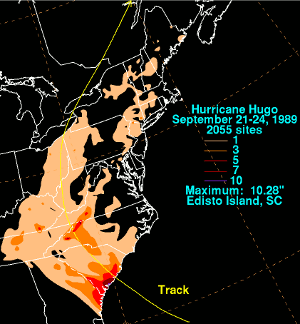
Rainfall was substantial but somewhat limited by Hugo's rapid movement. Edisto Island recorded 10.28 inches, Mount Pleasant received 8.10 inches, and even Savannah recorded 6.10 inches.
By the time Hugo was finished, its destruction stretched from the Caribbean through the Carolinas. At the time, it became the costliest hurricane in United States history, with the National Weather Service Charleston historical review estimating approximately $7 billion in damage.
Thirty-seven years later, Hugo remains one of the defining hurricanes in Lowcountry history. Its impacts on Sullivan's Island, Isle of Palms, McClellanville, Charleston and communities far inland demonstrate how a major hurricane can produce catastrophic effects well beyond the immediate point of landfall.
For the Coastal Empire and South Carolina Lowcountry, Hugo is also a reminder of something particularly important this time of year: September 21 is not late in hurricane season. Hugo struck near the climatological peak, and significant hurricane activity remains possible well into the fall.
Hurricane Hugo changed the Lowcountry in a matter of hours. Thirty-seven years later, its legacy remains part of the region's history — and a reminder of why hurricane preparedness matters every season.
Sources & image credits
Historical references: National Weather Service Charleston’s Hurricane Hugo review and NWS Wilmington’s Hurricane Hugo history. Image credits follow the NWS Charleston archive and appear beneath each image. Historical photographs and graphics are reproduced here from the supplied files.